
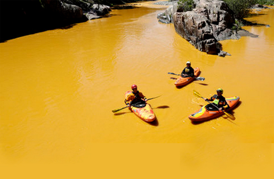
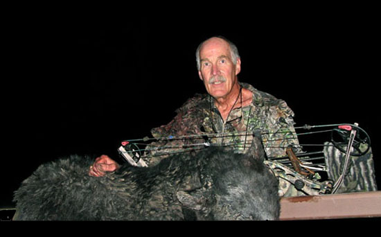
EPA turns river yellow-orange with waste spill
Emergency agent: ‘It’s really, really ugly’
KREM News
The city of Durango, Colo., and La Plata County, Colo., declared a state of emergency Sunday after the Environmental Protection Agency took responsibility for breaching a debris dam near a Colorado mine, releasing water contaminated with heavy metals into a river that flows through the region.
La Plata County Manager Joe Kerby said the decision stemmed from the “serious nature of the incident.”
Meanwhile, the Navajo Nation is considering suing the EPA. Navajo Nation President Russell Begaye told the Farmington, N.M., Daily Times that he had directed Navajo Nation Attorney General Ethel Branch to assemble a legal team to file a lawsuit against the EPA.
“They are impacting the livelihood of our people,” he said.
Begaye said he was disappointed with the EPA’s lack of information and disclosure about the types of toxic metals that were discharged into the Animas and San Juan rivers.
Begaye was also expected to declare a state of emergency in response to spill. He confirmed late Saturday that the plume containing toxic metals released from a mine near Silverton, Colo., was traveling through the reservation.
State leaders in New Mexico criticized EPA’s response to the spill. “There’s a lot of questions that our constituents have, and so many communities have as well, that we need to get rapid responses to,” said U.S. Rep. Ben Ray Luján.
New Mexico Gov. Susana Martinez said the state’s first notification of the spill came from Southern Ute Tribe officials. “It’s completely irresponsible for the EPA not to have informed New Mexico immediately,” she said after flying over the affected rivers.
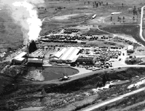
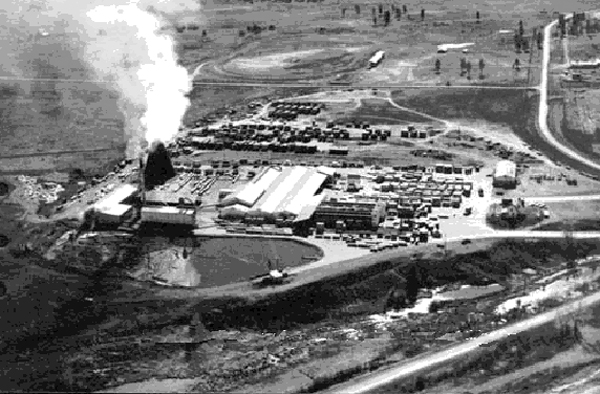
Pagosa Springs is fortunate in that no mines of significance were installed on the south and west side of the Continental Divide. Yes, there were a few small scale mines dug back into hard rock trying to get gold but no giant leach fields or water held in or above ground. Natives and longtime locals remember the Summitville Mine Disaster. A higher than average snowpack developed and washed away dams holding heavy metals. Summitville is just a few stone throws east of the Continental Divide south of Wolf Creek Pass and the leak went east down Wightman Fork and into the Alamosa River.
The environmental problems at Summitville have been of particular concern due to the extensive downstream use of Alamosa River water for livestock, agricultural irrigation, and wildlife habitat. Increased acid and metal loadings from Summitville are suspected to have caused the disappearance of stocked fish from Terrace Reservoir and farm holding ponds along the Alamosa River.
Pagosans all felt we ducked a big bullet with Summitville and now we feel the same way about the recent mining disaster.
Read below for a more detailed account of early explorers including mining of the area.
To set the scene for the European explorers’ first full-scale move into the San Juan, we must understand a few things. First, the San Juan and other places in the mountains were entered later than the lower lands. As man first traveled into these rugged mountains, they reported the rough terrain and the long, cold winters.
The early Spanish explorers that crossed the San Juan are outlined in accompanying articles on this website. Here we discuss not the first explorers, but the first white men to live and work in the San Juan: the trappers or “mountain men.” These were certainly a hardy group of men. They faced the San Juan with no roads and no maps. The Indian population was a constant danger, and even a simple accident could mean sure death. Only Indian hunting trails existed, and a man could only take along as much supply as a few horses or mules could carry. There were no wagon roads yet. The early mountain men had to face danger and death daily. They had to be able to consistently find and kill animals for food, and to insure they did not fall prey to bears or lions and become food themselves. They learned to survive by harvesting naturally growing food from friendly Indians.
The early mountain men were drawn into the San Juan in search of beaver and wildlife pelts. There was an active market for the pelts in the United States, in England and in Europe. The refined gentleman of the day developed a fashion trend of beaver fur on his coat lapel and also on winter hats; so this style created a “pelt rush” to satisfy the need.
Their life was not only harsh but also lonely. It was not a life for Anglo women. Fortunately, the trapper seemed to be the loner type. It has been said that these trappers were simply people who moved toward this type of life because they couldn’t get along in society.
They worked hard and often, wearing the same clothes for months on end. The mountain men came from all over Europe and the rest of the world. When they came across each other on a trail, there was a good chance that they could not communicate!
Joseph Williams, a Methodist preacher, entered an encampment and recorded a firsthand view of the mountain men. He said this camp was as wicked as any place he had ever seen. They were dirty and greasy, and his overall impression was poor; “They bought, sold, and gambled for Indian women, drank and swore continuously and fought each other without reason or notice.” Preacher Williams tried to save these evil men, but none would respond!
In the 1840s the fur business fell upon poor times. The “fur rush” was over forever. Also gone forever were the original mountain men, and the unexplored mountains he worked and lived in.
Some mountain men reported back to the “States” on the beauty and vast awesomeness of the Rockies. It was these reports that drew continued interest from the civilized world to the east. John Charles Freemont was an early “pathfinder,” sent by the government to forge a trail west through the San Juan. Mrs. Freemont’s books on his expeditions became popular reading. Freemont was inspired and guided by mountain men but failed several times. On one expedition he became stranded by an early snowstorm in the area just northeast of Pagosa Country. His men suffered greatly and had to eat their horses, mules, and each other to survive.
The government wanted and needed an easy trail to California. There were known passageways in other areas, but none across the southern Rockies in Colorado and New Mexico. The Grand Canyon made travel west of New Mexico impossible, so a route across the San Juan and north of the canyon was important.
Private citizens had tried to chart trails through the San Juan area, only to be turned back by the rough landscape. During the mid-1800s, the government earnestly began to chart a course. John W. Gunnison was ordered to carry out a survey for a railroad route through the San Juan. Antoine Leroux, an original mountain man, led the way for Gunnison and his wagons pulled by mule teams. Gunnison charted the path from Saguache to Montrose and beyond. In Utah, Gunnison was killed by Indians who were less than thrilled by the newcomers. Gunnison mapped the canyon that now bears his name.
Later, after the rush for gold became serious business, the government sent out scientific teams to survey the actual mountain landscape, rather than just trails through it. These survey parties, often including hundreds of men, lasted years and provided the first accurate maps, drawings and early photographs.
As the San Juan was some of the last of the unknown and uncharted land left in the United States, these surveys made the mountains less difficult to enter. A small rush of mankind soon followed.
The areas just southeast and west of the mountains were well populated. Santa Fe and Taos, New Mexico, supplied the fur-trapping mountain men during the early part of the century, becoming starting places for exploration, survey and settlement.
Denver had grown on the tails of the earlier Colorado Gold Rush that opened the northern mountains from the east. Some observant people noted the general layout of the mining towns. They formed a wide and elongated area. One end ran out of the mountains northeast, while the other pointed directly at the rugged San Juan. The mountain men had long ago reported seeing and collecting gold fakes in various rivers and streams where beaver were trapped. During 1858-59, interest continued to build in the northern mining district. In the “front range” (Denver, etc.) newspapers, it seemed to take on a competitive nature. Who would be first to reap the treasures of the San Juan?
A fellow named Charles Baker was the first recorded man to lead a group of prospectors. Instead of forging a path from the northeast, they went around the high ranges to Santa Fe and came into the San Juan from the south. Baker found gold at Euerika (just outside Silverton) and at Summitville (south of Wolf Creek Pass by a few miles). This started a small local “gold rush.” When word of the finds escaped the area, a full-tilt rush was on.
The Ute Indians were still in control of the San Juan and objected to large-scale movement of white man into the area. A few lone prospectors were allowed, but suddenly, small cities of men were traveling up from New Mexico and west from Del Norte in the San Luis Valley. For a short time the government feared Indian war–even ordered the white man out of the San Juan. The lust for gold was great, both for the prospectors and the government. Finally, a treaty was negotiated with the Ute leader (who wisely realized that the white man would, and could, wipe out his tribe). He agreed to the Brunot Treaty in 1873. The treaty moved the Utes west into Utah.
The prospecting miner was as unique an individual as the mountain men who preceded him. The miner was a dreamer and gambler. He usually arrived with a burro or two loaded with all his worldly possessions. The stories of riches for others only added to the dream, and each miner fully expected to strike it rich. Naturally, it did not work out that way. A few struck it rich, and the others worked for them. Their dreams were not quenched by seeing others growing wealthy, and most prospectors continued to look for their own “claim” in their spare time.
The earlier Spanish explorers and mountain men used long established Indian trails, but the mining locations demanded all new access paths across the area. In order to get supplies in, and gold ore out, there had to be improved roads. With improved roads, portable steam-powered, lumber milling machines were brought in. Lumber replaced heavy log construction. Houses and buildings could be put up quicker with less materials and work. The towns, at first, seemed to jump up from the ground overnight and were main streets with houses, cabins, and tents scattered about with a trail to the mine. Each town also had a trail that led to the outside world. Soon early trails and roads became better established. Some of these still exist as jeep-type trails, paved and unpaved roads and highways. Many were allowed to degrade to present-day hiking trails. It was not easy, but trains were also put into the San Juan to service the mining industry and ever growing population.
Adventuresome women joined the miners; and soon, towns grew into several streets with newspaper presses, schools, governments, and the ever-popular gambling/dance/prostitution halls. Most of the hundreds of small mining towns became ghost towns when the mining played out, but some held on to life and became centers for later cattle and sheep ranching.
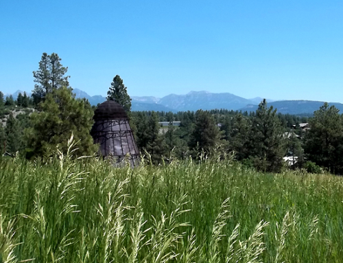
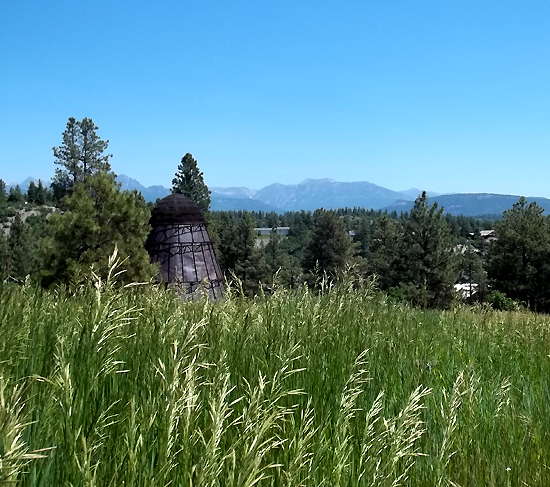
Ghost towns and mines in the San Juan are some of the most classic and interesting to be found in any location. While some were only mining camps with a name hung out, others were real, if temporary, cities. Various histories dictate what the present condition is like. On one hand there are ghost towns that are nearly invisible until you find foundations in tall grass. On the other hand there is Summitville, which has many standing houses, evidence of mining in the early and mid-twentieth century–a modern operation that became the Summitville ecological disaster over the last decade.
If you are interested in ghost towns there are several books for sale in shops that detail many with locations and histories.