
by Larry Larason
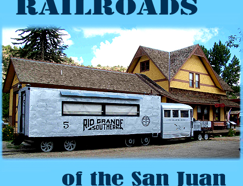
Four Corners Excursions
Two great rivers begin in the San Juan Mountains near Pagosa Springs. As you ascend Wolf Creek Pass, the streams flowing south are going into the San Juan River, a major tributary of the Colorado, which drains into the Pacific Ocean. On the north side of the Pass, waters flow into the Rio Grande, and, ultimately, into the Atlantic. The Continental Divide sweeps westward here across the crest of Wolf Creek Pass almost to Silverton to accommodate this drainage pattern.
When I think of Pagosa Springs I think of Mancos Shale, that gray-black mudstone that turns into gumbo when it’s wet. Like many of the rocks in the West that are impassable when wet, the Mancos contains volcanic ash that has altered to bentonite clay. Nearly the whole town is built on the Mancos. You see the gray cliffs as you approach from any direction.
The Mancos is Cretaceous in age. During that period a sea invaded the middle of the continent, from the Gulf of Mexico to Alaska. The first deposits are called the Dakota Sandstone. This sandstone is a tough, compact rock, yellowish in color on fresh breaks, reddish on long exposed surfaces. Fossil burrows are sometimes found in the Dakota. Although fossils of the creature, presumably some kind of shrimp, have never been found, it has been named: Ophiomorpha nodosa. Its burrows are well known in many of the Cretaceous rocks of the Four Corners. You can see them in the Pictured Cliffs Sandstone on the trail to the top of Chimney Rock.
As the sea deepened, 2000 – 4000 feet of Mancos Shale was deposited. In some places the shale is crisp and flaky, and there are some beds of limey sandstone. Parts of it include septarian concretions the size of watermelons, the veins filled with calcite. Fossil shells of ammonites and mollusks, and teeth of sharks, skates, and rays can be found sporadically, usually in lenses that smell of raw petroleum when you break them with a rock hammer. Because the Mancos Shale was laid down in oxygen poor waters, organic matter that fell to the bottom did not oxidize; this is why the shale is darkly colored. The seashore temporarily retreated. Rocks of the Mesa Verde Group were laid down on land when the sea went out. The first was the Point Lookout Sandstone. Then came the Menefee Sandstone.
During Menefee time, in ponds and swamps near the sea shore vegetation grew, died and was buried to become coal. The sea advanced westward again, and the Menefee was overlain by the Cliff House Sandstone, the uppermost member of the Mesaverde Group. The Cliff House Sandstone is another beach and near-shore deposit similar to the Dakota, and was overlain in turn, as the water deepened, by the Lewis Shale. The Lewis was deposited in the same conditions as the Mancos, and accordingly looks just the same. A layman would be hard pressed to distinguish one from the other.
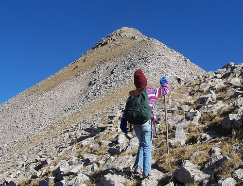
A slow-motion cataclysm named the Laramide Orogeny began in Jurassic times west of the center of the continent, but in the north-south band that includes Colorado, it was not felt until the end of the Cretaceous Period. Compression created by continental drift pushed up highlands including the San Rafael Swell, the Kaibab Uplift and the Monument Upwarp. Those were soon followed by the San Juan Dome and the Rocky Mountains. By the Early Tertiary, the San Juan Mountains were 20,000 feet higher than the San Juan and Paradox Basins on the south and west, also products of the orogeny, and erosion had exposed Precambrian rocks in the peaks. As the land rose, of course, the sea retreated.
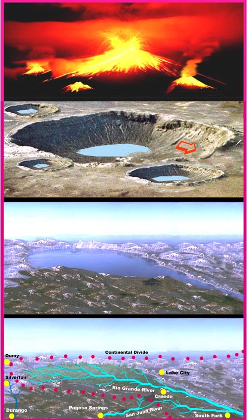
Another period of uplift followed, raising the Colorado Plateau another 5000 feet, and all hell broke out in the San Juan Mountains. About 40 million years ago volcanoes began belching ash and lava over the area. Ten million years later, the eastern San Juans were a vast volcanic plateau dotted by stratovolcanoes erupting ash at intervals to further bury the landscape. As the action moved to the south and west, eruptions became more cataclysmic. Enormous blasts of rhyolitic ash were followed by the collapse of the volcanoes into calderas ten to twenty miles wide above the emptied magma chambers.
The mother of all volcanoes erupted 27.8 million years ago, creating what is believed to be Earth’s largest caldera. The La Garita volcano seems to have erupted over the course of less than a week as much as 3,000 cubic miles of magma. This material, the Fish Canyon Tuff, makes up the La Garita Mountains and is found over a wide area north of Pagosa Springs. The “kill-zone” of this eruption probably extended well into Kansas. The resultant caldera is a rough oval about 22 by 50 miles wide, extending from Saguache Park across Creede and south into the Weminuche Wilderness west of Wolf Creek Pass. Fish Canyon Tuff can be viewed along Highway 160 on the pass. Unlike the much younger Valle caldera near Los Alamos, New Mexico, where you can see part of the crater’s walls, the La Garita caldera was obscured by subsequent volcanism, which continued over the next ten million years until the San Juans became quiescent.
Because it is mostly buried, it has taken geologists about thirty years to discover the true size of the La Garita Caldera; the southernmost portion was only identified in 1995. Following the volcanism, erosion cut deep valleys and canyons into the tuff and lava. Then, during the Pleistocene, a period of continental glaciation, ice caps formed over much of the San Juans. When the ice melted about 15,000 years ago, the mountains were left with over-steepened valleys where landslides and avalanches are common.
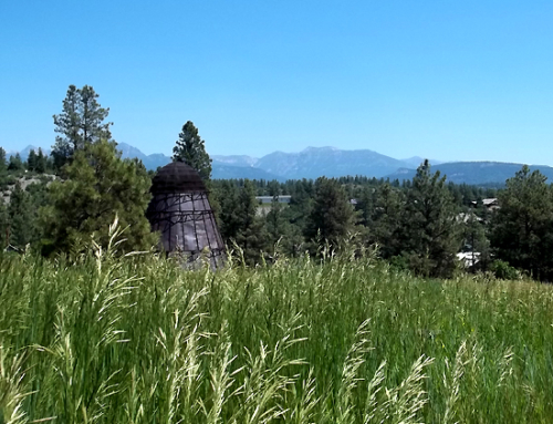
Hot springs are found where there has been geologically recent volcanism. There are several in the San Juans. The one at Pagosa Springs is the largest. Here, heavily mineralized waters reach the surface at more than 150 degrees. The water contains hydrogen sulfide, which accounts for the rotten egg odor you sometimes smell when you come into town. It also contains a large amount of dissolved silica [quartz] that precipitates as tufa when the water evaporates. [Tufa is similar to travertine.] You can see a part of these deposits across the river from the municipal parking lot. Man-made structures obscure the fact that the buildup of spring deposits was responsible for the bend in the river here. Although the spring discharges water at a rate of about 700 gallons per minute, it is used in the pools at the motels and to heat several buildings in town, so it no longer overflows to deposit more tufa along the river.

