
 Hiking Trails in Pagosa Springs
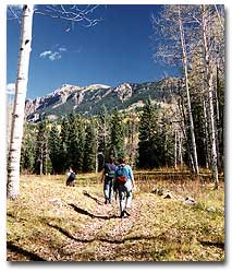
Awesome natural beauty draws most of the visitors to the Pagosa Springs area… however, many do not take the opportunity to hike “back in” and enjoy the beauty in a more intimate way. You can experience the unique sights, sounds, and fragrances of the San Juan National Forest by leaving your car behind and walking up a trail that winds beneath the towering pines and along a clear mountain stream. The following hikes cover a variety of terrain and are geared to different levels of ability. We hope you will stay awhile in Pagosa and return home with some of the unforgettable memories that any of these hikes will provide.
A couple of suggestions: If you are going to be more than 30 minutes away from your car, take a day pack with rain gear and a sweatshirt or sweater; mountain weather can change rapidly. You will also want to bring water and, perhaps, insect repellant. It is a good idea to pick up a national forest map; it more clearly shows access roads and trails. Maps of the San Juan National Forest may be purchased at the Chamber of Commerce Visitors Center.
REMEMBER: Let someone know where you are going, even if you’re just planning a day hike.
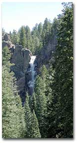
Fourmile Falls Distance: approximately three miles each way. A relatively easy hike, the Falls are among the highest in this region. Drive out of Pagosa Springs north on Fourmile Road; take the right turn just past Pagosa Peak Ranch, for about 14 miles to its end.
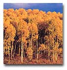
Opal Lake Distance: about two miles each way. It is a steep and twisting trail through an aspen grove, then across an open meadow to the lake. The lake is a nearly round body of water, contained by beaver dams, bordered by wooded hillsides and directly behind, sheer mountains loom upward. Head south out of Pagosa Springs on US Highway 84 approximately eight miles to Blanco Basin Road. Follow east to Castle Creek. Turn right across the Blanco River and follow the road two miles to a parking area identified by a sign denoting the trailhead.
Piedra Falls Distance: between 15 and 30 minutes each way. The Falls are impressive, thundering off a cliff into a v-shaped canyon of huge boulders. To get there, drive north on Piedra Road to Sportsman’s Supply, turn onto the road behind it, follow this road for two miles and take the East Fork Road (first road to the right) to its end. Walk up river to the headgate where the trailhead begins.
Williams Creek: No destination, start north of the reservoir and Cimarrona Campground, the trail follows Williams Creek northward into the Wilderness Area, edge your way along a narrow ledge on the side of a steep canyon, and marvel at a variety of mountain vistas.
Piedra River: A day’s hike at a moderate altitude (about 7,000 feet) with no long, steep climbs; follow a well-marked trail beside the Piedra. Start at either end of the trail – from the Piedra River crossing via Piedra Road, or from following US Highway 160 about 23 miles to where the Piedra River crosses under the highway. Follow the river via First Fork Road, approximately ten miles to the end of the road where the trailhead is. It is a good idea to leave a car or have someone meet you at one end or the other.
West Fork or Rainbow Trail Distance: 11.75 miles one way. Hot springs about five miles up trail but off beaten path (check with the Forest Service to find out exact location). This trail crosses both the West Fork of the San Juan River and Beaver Creek. Hikers need to proceed with extreme caution especially during spring run off. Access from Pagosa Springs is by US Highway 160 northeast for 15 miles, left on Forest Service Road 648, then past the West Fork Campground, crossing the West Fork of the San Juan River at mile 17.5 and on to the trailhead at mile 20.8.
Treasure Falls: At the western base of Wolf Creek Pass, can be viewed from US Highway 160 northeast of Pagosa Springs. A short trail leads to the falls.
Continental Divide Trail Distance: 80 miles. The most exciting trail in the Weminuche Wilderness, it traverses through the most remote and beautiful sections of the Wilderness. Easiest access: US Highway 160 northeast to Wolf Creek Summit then left a short distance further on a road that leads to a telephone microwave tower to the end. The Continental Divide Trail also extends south – from the Wolf Creek Pass Summit into New Mexico.
Quartz Lake Trail Distance: about 3.5 miles each direction. Quartz Ridge is actually 12,349 feet high – well above the tree line, yet reachable from a good gravel road. Drive out Mill Creek Road (at the Red Ryder Rodeo grounds) 15 miles. Leave Mill Creek Road and follow Nipple Mountain Road near-ly to the end. Watch for a sign marking the trail-head.
Cimarrona Creek Trail Distance: 6.5 miles one way. The trail wanders through conifers and aspen. Take Piedra Road north to Williams Lake Road. Cimarrona Trail begins on Williams Lake Road at mile 4.1, just beyond the entrance to Cimarrona Campground on the left side.
Middle Fork Trail Distance: 10.6 miles one way. The Middle Fork Trail is steep, exposed to storms and offers little camping. Drive north on Piedra Road to Sportsman’s Supply. Turn onto road behind it continuing until the Middle Fork Hunter Campground.
Turkey Creek Trail Distance: 18.6 miles one way. With some of the best scenery to be found in the entire Wilderness, head northeast from Pagosa Springs on US Highway 160 for 7.3 miles. Turn left on Jackson Mountain Road. Follow it for four miles to the end where the trailhead for Turkey Creek Trail is located.
Williams Creek Trail Distance: 9.5 miles one way. The old Spanish name for Williams Creek was Huerto: “garden-like.” The first few miles of Williams Creek do give the impression of a gigantic, walled garden. Take Piedra Road north for 22 miles, and then take Williams Lake Road to its end – about 4.75 miles where the trail begins.
Treasure Mountain Trail Distance: approximately 10 miles total. Begin at the top – Wolf Creek Pass on US Highway 160, about 10,500 feet, just east of the summit marker where the Continental Divide Trail winds southward and connects with the Treasure Mountain Trail at Treasure Pass after a hike of a mile or two.