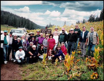
Pagosa Springs Off Road Trails – East Fork Road and Elwood Pass

by Norm Vance
The East Fork Road and Elwood Pass are special places in Pagosa Country. The East Fork of the San Juan River flows down from the lofty heights of the Continental Divide. Water from melting snow plunges down a narrow canyon and then flows into a great wide valley at lower elevation and then into the San Juan River. This is one of the few remaining hardcore jeep trails that crest the Continental Divide.
The East Fork Road allows people with bicycles, ATVs, off-road motorcycles or four-wheel-drive vehicles access to this beautiful valley.
An extra treat is that once you are over the summit of the Continental Divide at Elwood Pass, there are a variety of jeep trails, forest access roads, and Summitville, a gold mine, ghost town and site of the USA’s largest environmental disaster, and the town and lodge at Platoro, Colorado.
Driving East Fork and Elwood Pass is great adventure. From Highway 160 the East Fork road is good enough for cars for a few miles. It follows the river through a narrow rocky canyon and then opens into a wide valley. Note the private property signs. It is on this property that the river way was turned into a channel by gravel pit operations and later returned to a more natural meandering river by its owner and a river hydrologist.
Near Silver Falls, the road has a dip that challenges the ground clearance on lower cars – judge for yourself. The road grows rougher as it leaves the wide valley. At the right turn to Quartz Creek there is a large sign designating the road beyond as four-wheel drive only, BELIEVE IT! Lock the front axles and use first gear and low range to continue.
Driving up to the divide is steep, rocky and a real challenge. There are many points to stop, rest and look around. Some places exist where you drive up and over steep rounded bare rock so that you cannot see the road ahead. Look first and stay to the inside or left and do not stop once climbing. There are places where the road is cut into near-vertical rock walls with sheer drop-offs to the valley below. Go slowly and carefully, as the right shoulder is a long, long way down.
Be on guard when the road is wet and in spring when the two river crossings are deep and swift. In spring, snow run-off down the river could sweep a vehicle away. Hard rain during the summer can refill the river crossing and make the road muddy and slick in many places. In autumn, snow can blanket the area and stop passage as early as October.
At the only fork in the road you’ll see an aspen tree with directions to turn left to Elwood Pass cut into the bark. The road straight ahead is a short but rough drive to the Black Diamond Mine and is a nice side trip and stop. Don’t venture into the mine. In the area of this fork is the site of Elwood Mining Camp. There are no visible remains of this camp that, in 1879, had the first post office in the area.
Once you crest the divide, you’ll find a nice forest access road. A right turn will take you to Platoro, Colorado and ultimately to New Mexico Highway 17 and Chama, New Mexico. This is a stunningly beautiful drive to Platoro and beyond. There is a sign denoting the scenic spot where the state’s song was written. Another place is passed with a small lake and a bit of private property with small cabins. It is so beautiful here that the mind is stressed to leave.
A left turn at the summit of Elwood Pass takes you to an intersection in a couple of miles. A sign points the way down Park Creek Road to US Highway 160 for a return drive to Pagosa or to Summitville-Grayback Mountain.
Don’t miss Summitville. This is a ghost town where you walk down the streets between old rickety houses. Watch children carefully and don’t enter the buildings because the floors are weak from age. Across the road from the ghost town you can’t miss the Summitville Mine, it is a mammoth scar on the earth where the many mining operations blew out and removed half of the mountaintop to get at the gold. Just beyond the ghost town is a short lane left from the main road up to a large billboard that displays the Environmental Protection Agency’s work repairing the Summitville environmental disaster. This is a superb educational opportunity for everyone and especially for youngsters.
Along all of the roads in this area watch for unusual formations of dirt on mountainsides. They are obvious and stand out in the trees. The formations look exactly like what they are, dirt thrown down the mountainside. These represent mine sites where dirt, called tailings were dugout and cast aside while mining for gold.
Check your forest service map for other features and drivable trails. This off-road adventure is a real thrill for drivers and passengers alike. There are few places where the scenery and excitement of East Fork Road and Elwood pass can be found. Be cautious and have a great time!


Do you have Jeep or bus tours that a couple could take up Wolf Creek Pass on hiway 160 without driving our own car. Is it as steep as Pikes Peak. Does it have a cog Railway like Pikes Peak. Our time of vacation is late August
It is the main highway into town and all cars come into town over Wolf Creek. You do not need a bus or Jeep to go over it.