Hiking / Climbing Pagosa Peak

 See this photo in enlarged format click here.
Disclaimer. The commonly used trail to Pagosa Peak described here is not an official trail nor is it shown on the Forest Service map. Exercise extreme caution, travel with a good map and be careful. This map is not for navagation and is shown only to give direction to the trail.
The quickest route is north on Piedra Road. Turn left on McManus Road and on to Black Mtn. Road. The eastern route is north on Fourmile Road from the center of downtown and left on Plumtaw Road. This is a longer slower drive.
The usual (if not official) trail that most people take to climb Pagosa Peak is located on Black Mountain road, an access route off Plumtaw road. The road is in terrible shape, a state relatively unchanged in the past twenty years: rutted, rocky, occasionally steep. Low clearance vehicles are NOT advised to attempt. The road is also fairly narrow, except for one notable curve in the final set of switchbacks. This curve is distinguished by its unusual width (for parking access) and by the identification marker as seen the photo below—an orange hat is currently placed on a staff. If you come to the end of the road, you’ve gone too far.
The trail has a fairly consistent uphill grade throughout. The initial ascent wends through conifers of spruce, fir and pine toward a gap. Occasionally the foliage will break, granting hikers views of surrounding mountains, a streambed the trail follows, and several scree gardens. You’ll know when you reach the gap, as one is presented with a pleasant view of the Four Mile Falls valley and the eastward mountains: Eagle Mountain and Eagle Peak being prominent of those exposed. If one gazes directly below, the Anderson Trail can be spied as it snakes through the conifers and switchbacks up Pagosa Peak’s lower southeast flank.
From the gap the hike gets progressively harder. The (relatively few) level areas and descents are no more; the hiker is now climbing Pagosa Peak’s southward ridge. Once you reach tree-line the views become spectacular. One can see Pagosa Springs to the south and the Weminuche wilderness to the north, east and west. Talus and loose scree armor upper Pagosa Peak, and though the consistent traffic has greatly reduced the chances of one’s ground giving way, caution is advised. A substantial drop looms consistently to the right of the hiker, and those with vertigo may wish to utilize a hiking stick or the helpful arm of a fellow traveler for comfort.
See this photo in expanded format click here.
Parts of the trail are very steep and with loose stones. WYS!
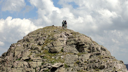
Pagosa Peak has a sly trick. Once you huff and puff your way to the summit, you are rewarded with the sight of the real peak a hundred meters or so away. Yes, that divot at the top one can observe from town actually means there is a false peak; rumor holds that more than one traveler in the past has contemplated giving up at the false peak instead of hoofing the last little bit. It really isn’t far, however, and once you reach the real peak you’ll have the bragging rights, to wit: you’ve mastered Pagosa’s most famous peak at over 12,600 feet. Take a swig of water and enjoy the 360-degree panorama.
Above timberline and into the clouds.
See this photo in enlarged format click here.
Ian and Mom Vance on the summit.


Thanks for the awesome and detailed info! How long did it take for you to summit Pagosa?
It depends on how good of shape the individual is in, but it can take 2 hours+ hours to summit Pagosa Peak.